Blank Map of Kansas
A blank map of Kansas showing all 105 counties. Choose a style, color it in, and download it free as SVG, PNG, JPG, WebP or PDF.
- 105 counties
- Vector SVG
- Print-ready PDF
- Free for any use
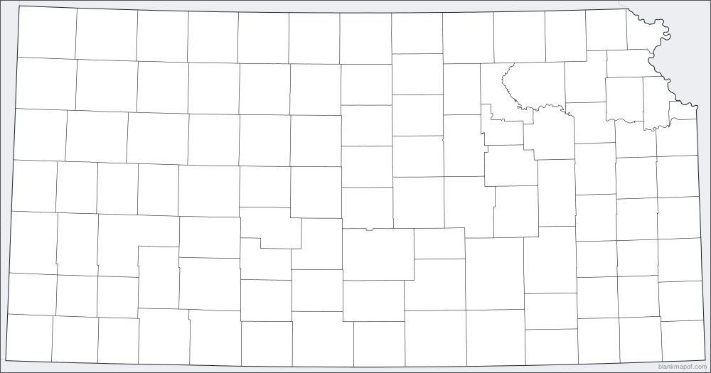
Hover or tap a county to see its name
Boundaries: US Census Bureau (Cartographic Boundary Files 2024), Public domain.
Answer key
- Cheyenne County
- Rawlins County
- Decatur County
- Norton County
- Phillips County
- Smith County
- Jewell County
- Republic County
- Washington County
- Marshall County
- Nemaha County
- Brown County
- Doniphan County
- Sherman County
- Thomas County
- Sheridan County
- Graham County
- Rooks County
- Osborne County
- Mitchell County
- Cloud County
- Clay County
- Riley County
- Pottawatomie County
- Jackson County
- Jefferson County
- Atchison County
- Leavenworth County
- Wallace County
- Logan County
- Gove County
- Trego County
- Ellis County
- Russell County
- Lincoln County
- Ottawa County
- Saline County
- Dickinson County
- Geary County
- Wabaunsee County
- Shawnee County
- Douglas County
- Wyandotte County
- Johnson County
- Greeley County
- Wichita County
- Scott County
- Lane County
- Ness County
- Rush County
- Barton County
- Ellsworth County
- Rice County
- McPherson County
- Marion County
- Morris County
- Lyon County
- Osage County
- Franklin County
- Miami County
- Hamilton County
- Kearny County
- Finney County
- Hodgeman County
- Edwards County
- Pawnee County
- Stafford County
- Reno County
- Harvey County
- Chase County
- Greenwood County
- Coffey County
- Woodson County
- Anderson County
- Allen County
- Linn County
- Bourbon County
- Stanton County
- Grant County
- Haskell County
- Gray County
- Ford County
- Kiowa County
- Pratt County
- Kingman County
- Sedgwick County
- Butler County
- Elk County
- Wilson County
- Neosho County
- Crawford County
- Morton County
- Stevens County
- Seward County
- Meade County
- Clark County
- Comanche County
- Barber County
- Harper County
- Sumner County
- Cowley County
- Chautauqua County
- Montgomery County
- Labette County
- Cherokee County
Ready-made styles
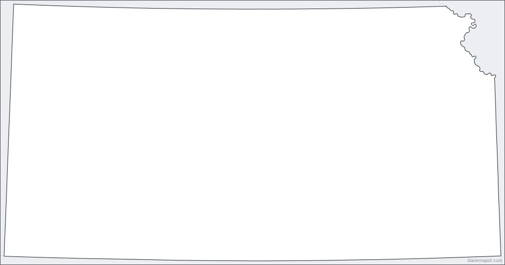
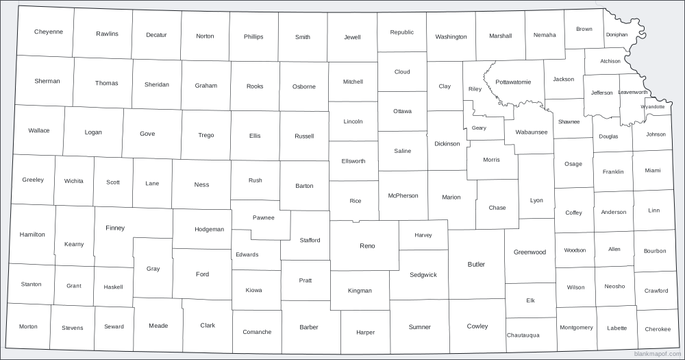
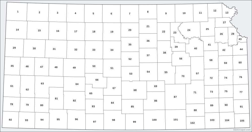
Blank map of Kansas styles
Download any style instantly as SVG, or open it in the editor to change colors and export PNG, JPG, WebP or PDF.
Quick facts
About Kansas
- Counties
- 105
- Map projection
- Lambert azimuthal equal-area
On this map
Counties (105)
- Allen County
- Anderson County
- Atchison County
- Barber County
- Barton County
- Bourbon County
- Brown County
- Butler County
- Chase County
- Chautauqua County
- Cherokee County
- Cheyenne County
- Clark County
- Clay County
- Cloud County
- Coffey County
- Comanche County
- Cowley County
- Crawford County
- Decatur County
- Dickinson County
- Doniphan County
- Douglas County
- Edwards County
- Elk County
- Ellis County
- Ellsworth County
- Finney County
- Ford County
- Franklin County
- Geary County
- Gove County
- Graham County
- Grant County
- Gray County
- Greeley County
- Greenwood County
- Hamilton County
- Harper County
- Harvey County
- Haskell County
- Hodgeman County
- Jackson County
- Jefferson County
- Jewell County
- Johnson County
- Kearny County
- Kingman County
- Kiowa County
- Labette County
- Lane County
- Leavenworth County
- Lincoln County
- Linn County
- Logan County
- Lyon County
- Marion County
- Marshall County
- McPherson County
- Meade County
- Miami County
- Mitchell County
- Montgomery County
- Morris County
- Morton County
- Nemaha County
- Neosho County
- Ness County
- Norton County
- Osage County
- Osborne County
- Ottawa County
- Pawnee County
- Phillips County
- Pottawatomie County
- Pratt County
- Rawlins County
- Reno County
- Republic County
- Rice County
- Riley County
- Rooks County
- Rush County
- Russell County
- Saline County
- Scott County
- Sedgwick County
- Seward County
- Shawnee County
- Sheridan County
- Sherman County
- Smith County
- Stafford County
- Stanton County
- Stevens County
- Sumner County
- Thomas County
- Trego County
- Wabaunsee County
- Wallace County
- Washington County
- Wichita County
- Wilson County
- Woodson County
- Wyandotte County
Select a name to highlight it on the map.
Inspiration
Ideas for your blank map of Kansas
Geography quizzes
Print the numbered map and ask students to name each county. The answer key is included.
Coloring & art
Kids can color the outline by hand, or you can paint counties here before printing.
Presentations
Drop the SVG or transparent PNG into slides, reports and posters, then recolor it to match your brand.
Data maps
Color counties by any value (population, sales, visits) for a quick hand-made choropleth.
Travel planning
Mark where you have been or want to go and print it for your wall or journal.
History & current events
Sketch routes, empires, trade links or news stories on a clean base map.
Help
Frequently asked questions
Is this blank map of Kansas free?
Yes. Every map on blankmapof.com is free for personal, classroom and commercial use, with no sign-up. A small blankmapof.com credit is added by default, and you can switch it off before downloading.
How do I print a blank map of Kansas?
Choose PDF, pick A4 or US Letter and download. The map is scaled to fit the page with margins. The numbered version adds a name/date line and a second page with the answer key, so it works as a ready-made worksheet.
Can I edit the map in other software?
Yes. Download the SVG: it is a true vector file with separate shapes for every county, so you can open it in Adobe Illustrator, Inkscape, Figma, Canva, PowerPoint or Google Slides and change anything.
How many counties are in Kansas?
Kansas has 105 counties. All of them are shown on this map, and each one can be colored, labeled or numbered.
Which map projection is used?
This map uses the Lambert azimuthal equal-area projection, chosen so the region keeps a natural shape and true relative sizes where possible.
Where does the map data come from, and whose borders are shown?
Counties come from the US Census Bureau (Cartographic Boundary Files 2024, public domain). Neighboring states and countries come from Natural Earth (public domain).
Keep exploring
More blank maps
Colorado
All 64 counties.
Missouri
All 114 counties and 1 independent city.
Nebraska
All 93 counties.
Oklahoma
All 77 counties.
Alabama
All 67 counties.
Alaska
All 13 boroughs, 4 cities and boroughs, 2 municipalities and 11 census areas.
United States
All 50 states.
North America
Canada, the US, Mexico, Central America and the Caribbean.